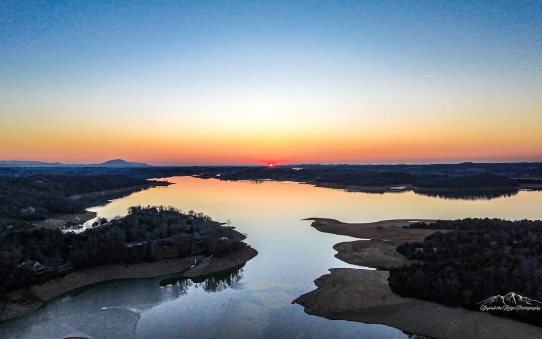
Douglas Lake is known for its sparkling summer waters, amazing fishing, and long golden evenings sitting in the shadows of the Great Smoky Mountains. But each winter, when the Tennessee Valley Authority lowers the lake for flood control and reservoir management, a second landscape quietly emerges.
To capture this remarkable seasonal transformation, we partnered with local photographer Beyond the Ridge Photography, whose close-up and drone imagery reveal the dramatic textures and sweeping scale of Douglas Lake’s winter terrain.
And it is nothing short of extraordinary.
")
")
")
Douglas Lake is not a natural lake. It is an impoundment of the French Broad River, created in 1943 with the completion of Douglas Dam as part of the wartime effort to generate hydroelectric power for aluminum production during World War II. What filled with water each spring was once a winding river valley with ridgelines, farms, rock outcroppings, and ancient geological layers shaped over millions of years.
When winter drawdown occurs, those hidden layers reappear.
")
What some first-time visitors call “bare” or “muddy” reveals itself, upon closer look, as something far more dramatic. Limestone shelves stretch like frozen waves. Jagged formations rise in angular stacks. Striated rock patterns curve and fold like sculpture. In certain light, the exposed lakebed resembles a canyon floor in the American West or, as many have said, something almost lunar. Moon rocks. Mars. Otherworldly terrain.
These formations tell a deep-time story. The region sits within the Ridge and Valley geologic province of East Tennessee, where sedimentary rock layers were folded and faulted hundreds of millions of years ago during the formation of the Appalachian Mountains. The same forces that lifted the Smokies also compressed seabed sediments into the limestone and dolomite now visible along Douglas Lake’s winter shoreline.
")
")

In summer, the lake is defined by water – recreation, boating, fishing, and reflection. In winter, it becomes defined by texture, shape, and history. Photographers are drawn to the sweeping drone views that highlight the dramatic contrast between exposed stone and still water. Hikers and explorers discover details normally hidden beneath full pool. Angles sharpen. Colors soften. The landscape feels raw and elemental.
It is not a season of absence.
It is a season of revelation.

The annual drawdown is practical and purposeful, protecting downstream communities, preparing for spring rains, and continuing the mission Douglas Dam was built to serve. Yet it also offers something unexpected: a rare glimpse into the geological bones of the valley.
Two seasons. Two perspectives.
A shimmering summer lake.
A sculpted winter terrain.
Two landscapes. One destination.